A step-by-step guide to your visit
This page will guide you throughout your visit. Here you will discover the history of the site, the main periods of its occupation, and the various features you will see as you walk up to and explore the castle.
ℹ️ Reading time: 10 minutes • Average duration of visit: 2 hours
Montségur before the Cathars
Archaeological research has revealed that signs of human presence on the « pog » (rocky outcrop) date back to the Bronze Age. Artefacts (tegulae, coins and ceramics) also suggest Gallo-Roman activity on the site.
The Cathars period of Montségur (1204 – 1244)
In 1204, before the Albigensian Crusade (1209-1229), the local lord Raymond de Péreille was asked to « rebuild the castrum of Montségur ». The castrum (fortified village) was home to the Cathar clergy, believers, knights between 1204 and 1244. At maximum, more than 500 people where living at it’s summit. In 1232, Montségur became the headquarters of the Cathar Church.
Catharism
Cathars were medieval Christians who rejected the authority of the Catholic Church. It was a dualistic faith in which the Good, associated to God and spirit, was the opposite to the Evil, in which material and earthly world belong to. They were believers or « Good Men » and « Good Women », spiritual pillars of catharism. After receiving the Consolamentum (main rite of the Cathar faith), they devoted themselves to a life of work and prayer.
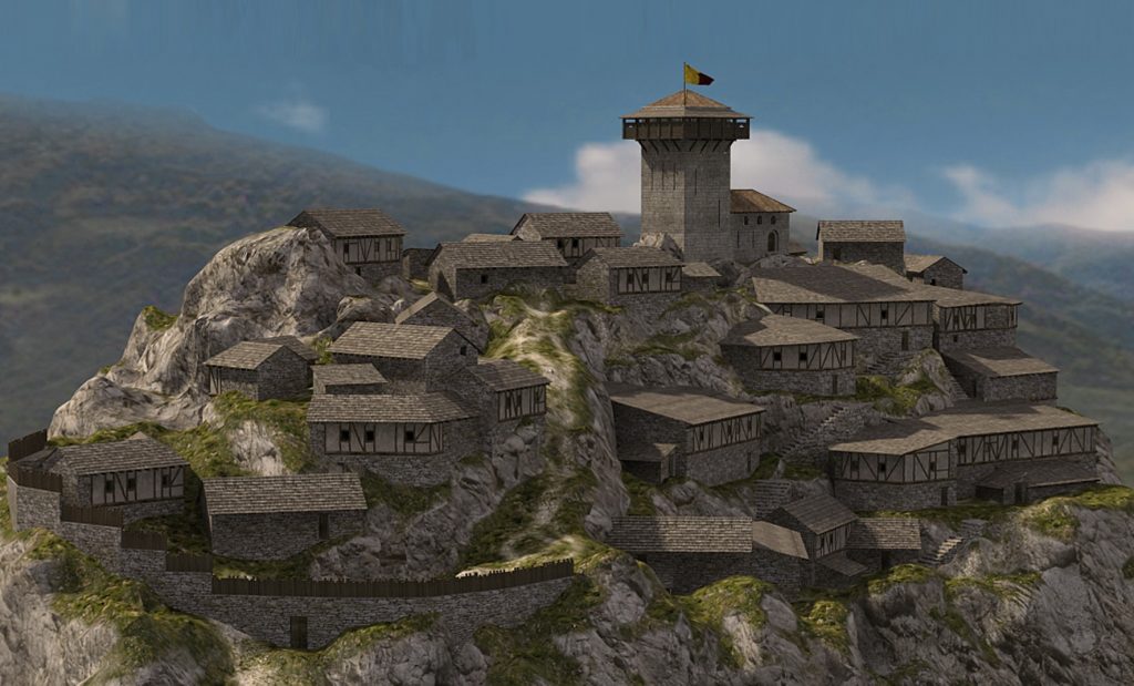
The life on the Pog
Over time, the castrum of Montségur grew into a real fortified mountain village spread across the summit of the pog. Houses were built along the cliff edges and connected by a dense maze of narrow streets, stairways and passageways.
The Siege and Fall (1243 – 1244)
After a first failed siege in 1241 and the killing of the inquisitors at Avignonet in 1242, the royal army laid siege to Montségur in May 1243. From May to mid-December 1243, the defenders successfully held off the crusaders. But around Christmas 1243, the capture of a fortified outpost known as the Roc de la Tour by a crusader commando changed everything. From there, siege engines were installed and the defenses were gradually destroyed.
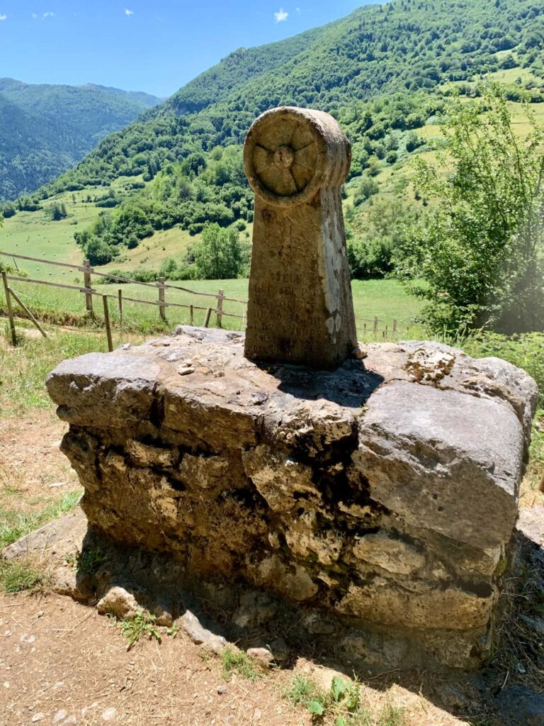
On March 2, 1244, the garrison surrendered and a truce was granted. On March 16, 225 Cathars who refused to renounce their faith were burned alive at the foot of the Pog, in a place now known as the “Prat dels Cramats.”
After Montségur
At the end of the 13th century, a new fortress was built on the ruins of Raymond de Péreille’s former castrum by the Lévis family. This reconstruction took place during a tense period marked by border conflicts between the kingdoms of France and Aragon. The castle later became a secondary stronghold.
Visiting Montségur
The climb begins with a steep path crossing the “Prat dels Cramats,” believed to be the site where 225 Cathars were executed for refusing to abandon their faith. Further up stands the memorial stele dedicated to March 16, 1244.
The path then leads deeper into the forest. Walk through the undergrowth: it is as you emerge from the trees that the archaeological exploration of Le Pog really begins.
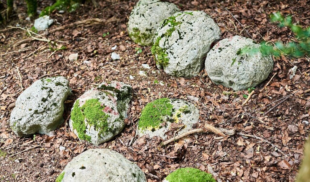
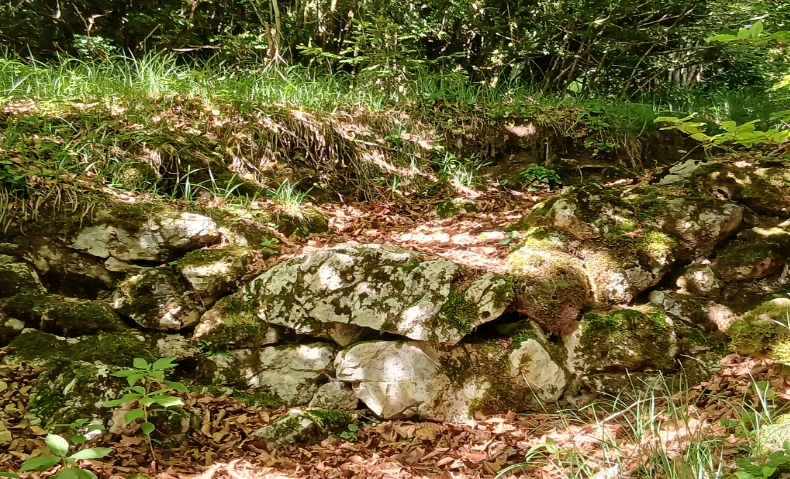
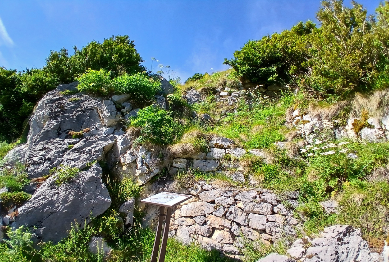
Along the trail, you will notice remains of dry-stone masonry — the earliest traces of the Cathar castrum.
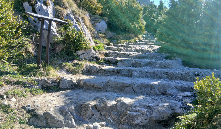
Higher still, steps carved directly into the rock, known as the “donkey steps,” were designed to help equidae reach the summit.
After these steps, you will come across the remains of an impressive dry-stone wall : the first fortified wall of the Cathar castrum.
As you climb a little further up and look up, the fortress suddenly seems to tower above you. It is here, in the southern part of the castrum, that the first terraces come into view – these once housed the dwellings of the Cathar village. As you continue to look around, you will also notice the remains of other defensive walls that once protected this side of the mountain.
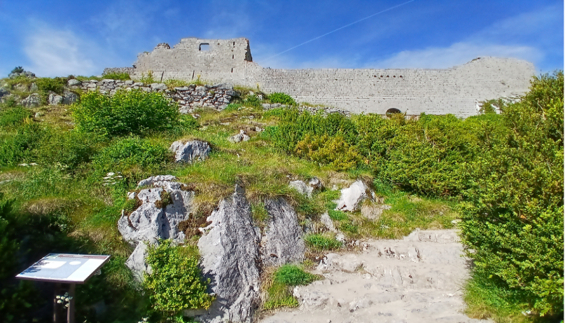
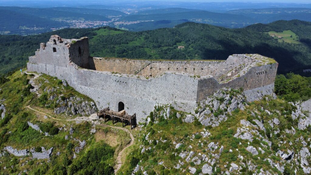
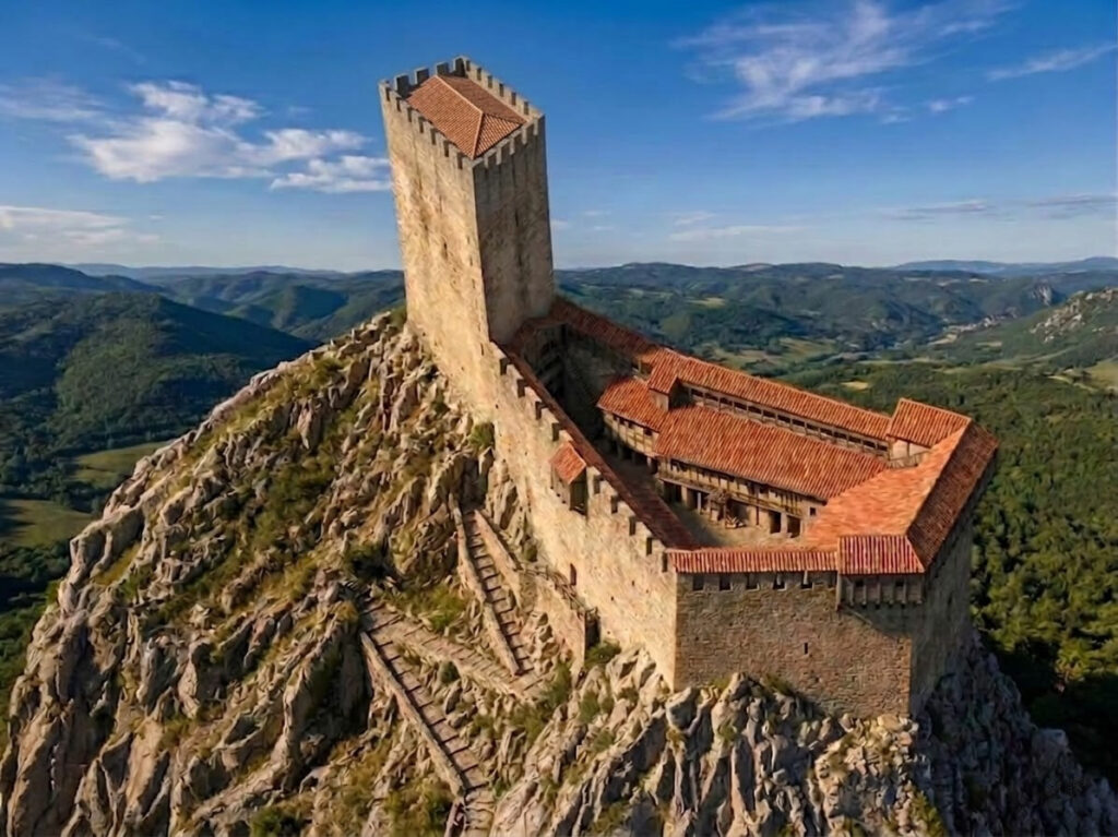
At the foot of the castle, the historical period suddenly changes. The fortress you see today was built after the destruction of the Cathar castrum, during the reign of King Philip III of France, known as Philip the Bold (1270–1285).
Following the Albigensian Crusade, Languedoc became part of the French Crown. Yet beyond these mountains lay the County of Foix, under the authority of the Kingdom of Aragon. In this context, Montségur became part of a strategic network of border fortresses designed to protect the frontiers of the French kingdom.
The castle courtyard once contained several buildings — living quarters, barns and stables — of which only traces of beams and stairways remain today.
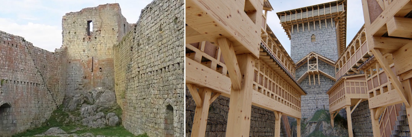
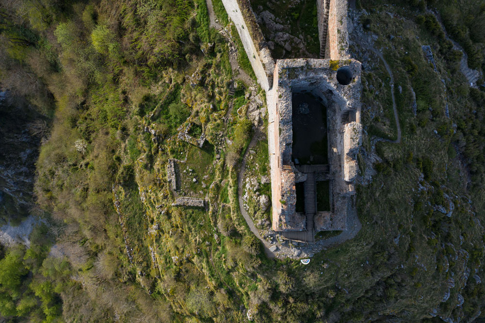
The keep towers above the site. Originally, it stood taller than it does now. Archaeologists believe that at least one floor and the roof are missing. The current entrance is not original : visitors now enter through what used to be the castle cistern.
Originally, access to the keep was through a doorway on the first floor. This level featured four windows with stone benches. A door opened onto a spiral staircase leading to the upper floors and down into the lower chamber. This lower room, similar to a cellar, was covered by a stone vault, traces of which can still be seen today. Equipped with five arrow slits, it served both defensive and storage purposes.
Outside the castle, below the keep, there are terraces. These are the vestiges of the former Cathar castrum — homes, cisterns and extremely narrow stairways. At the Montségur Museum, digital reconstructions help visitors better understand how the castrum was organized.